County-wide Fuelbreak Mapping (18-86)
County-wide mapping of fire fuels reduction projects, fire history, land ownership and more. Funded by the NRCS and hosted courtesy of Shasta College and FarNorCalGIS. View the map here.
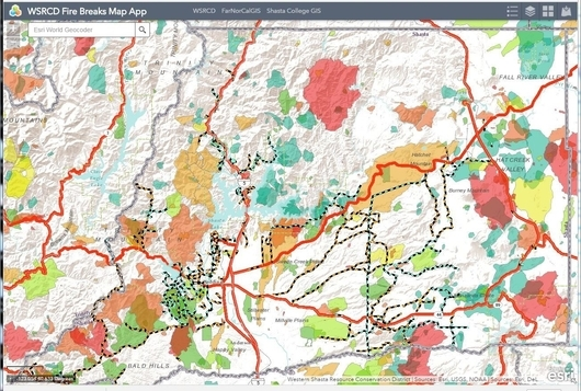
County-wide mapping of fire fuels reduction projects, fire history, land ownership and more. Funded by the NRCS and hosted courtesy of Shasta College and FarNorCalGIS. View the map here.